Annapurna Circuit Trek
14 Days
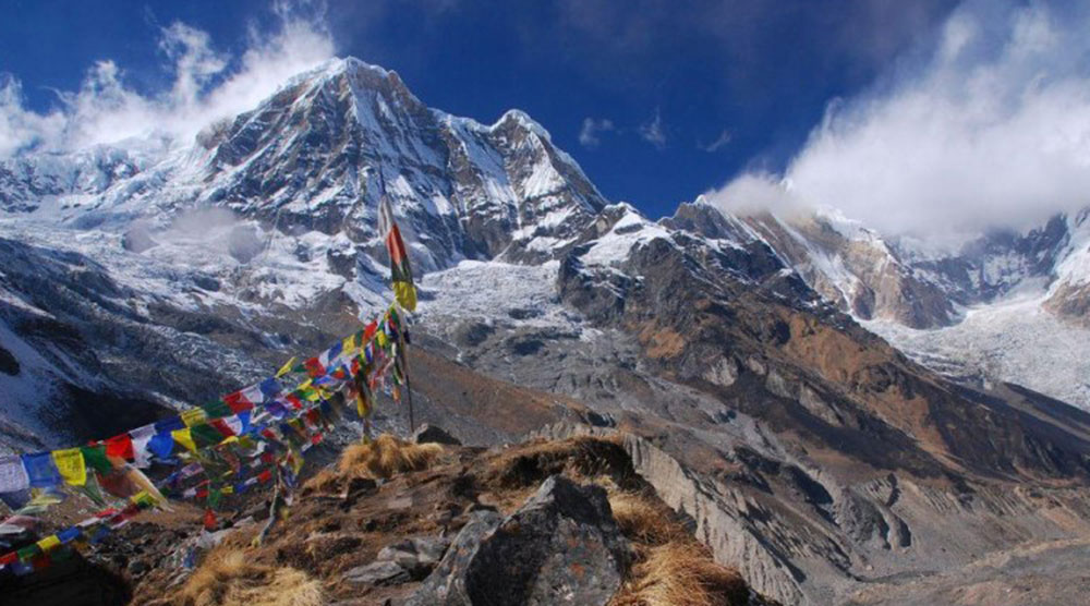
Annapurna circuit trek is considered as one of the ultimate trekking experience in Nepal. In 1980 it was opened for interested trekkers and since then to present date the circuit was possible for the adventure travelers. The region loaded with adventures and rich sceneries of mountains panorama, beautiful landscapes and local Manangi people and their lifestyles.
It’s a 14 day trek starting from Besisahar and ending at Jomsom. During this Trek one experiences the diverse choice of hiking and trekking enjoying Manang that is often known as the Grand Canyon of the Himalaya.
Detail Itinerary
Day 1 - Drive to Besi Sahar [820m]
With high intensity of physical fitness, enough adaptation and good logistic support, we start our Annapurna trekking. Driving along the Kathmandu-Pokhara Highway to Dumre and then next the rough route by the Marsyangdi River, we pass through the low-lying community and rice fields. After 6 hours long drive, we finally reach Besi Sahar. Besi Sahar is the capital of Lamjung District.
Day 2 - Trek to Khudi [790m]
From Besi Sahar, we trek along the trail turning right at the canal on the border of the village and downward the narrow path to the Pam Khola. On crossing the stream, we ascend towards the village of Denauti where we get to see Nepali community life at close quarters. The path further leads to the banks of the Marshyangdi Khola, passing through paddy fields and subtropical forests. As the trail nears the Khudi Khola, we come close to the Gurung village of Khudi.
Day 3 - Trek to Bahundanda [1310m]
As we stride northwards up the Marshyangdi Valley, away from Khudi, we get to see the wonderful Annapurna mountain ranges. The track winds through a suspension bridge and follows terraced rice fields, offering magnificent views of Manaslu and cascading waterfalls. Further, as the track goes uphill, we spot several shops and teahouses at Ngadi village. On leaving Ngadi after a brief rest, we skirt through the difficult trails to Bahundanda. Bahundanda literally means “Brahmin hill” and as the name suggests Bahundanda is largely populated by Brahmins. Here we conclude our trekking trip for the day.
Day 4 - Trek to Jagat [1290m]
A steep trail descends from Bahundanda, through rice fields, before crossing a stream at the bottom of a small waterfall. It then climbs again and traverses the hillside high above the river before reaching the village of Hani Gaon. Ahead, the Marshyangdi valley forms a steep V-shape. We follow the winding mountain path down through Syange and along the river for some distance. The trail then climbs sharply and the path is cut into the sheer cliff-face some 200-300m above the riverbed. Eventually we descend to the stone village of Jagat, located on a shelf, which juts out into the precipitous Marshyangdi valley.
Day 5 - Trek to Dharapani [1920m]
The track from Jagat descends until it reaches the river and then continues through a lush forest. Further climb leads to sharp-edged cliff facing the riverbank. En route, Chyamje comes into image amidst the wonderful backdrop of towering Annapurna mountain ranges. After crossing a suspension bridge, we climb steeply towards the slippery and physically challenging path to Sattale. On treading along a succession of rock-strewn trails, we descend to a green riverbank that leads to Tal. As we walk away from Tal, the path becomes rugged and winding. Then we move toward the steep forested village of Karte. Meandering along the waterfalls and cliffs, we finally reach Dharapani after crossing a suspension bridge.
Day 6 - Trek to Chame [2630m]
We skirt through a narrow field from the village. The Dudh Khola, which originates from the south face of Manaslu and then Marshyangdi veers to the left. Sinuous trails of the. Annapurna II becomes evident as we arrive at Bagarchhap, a Bhotia village with colorful prayer flags fluttering in the gentle wind. As we continue climbing through forests of pine and oak, we pass through Dhanakyu before coming to a thundering waterfall. Further on, the Marshyangdi river enters a gorge and the trails follows rock-strewn path. We can pause for a while and take in the majesty of the picturesque Manaslu.
When the steep incline ends, we follow a path amid splendid rhododendrons and continue on a gently rising path. We cross a stream before entering a pine forest. We then enter the pristine hamlet of Kotho, from where we can confine the most enchanting view of Annapurna II. Treading further, the route reaches a large white gate with a corrugated iron roof, which is the opening of Chame. Chame is the administrative headquarter of Manang district. There is electricity, wireless station, schools, shops, health post, post office, police check post, hotels, lodges and banks in Chame. The hot springs are the main magnetism of this place.
Day 7 - Trek to Pisang [3190m]
After a compelling sight of the glowing Lamjung Himal [6893m] in the morning, we head off for Pisang. En route, we cross a large suspension bridge along Marshyangdi and come up to houses and lodges on the northern side of the river. Our trekking track meanders through barley field leading to Teleku at 2775 meters. As we leave heaving mountain passes, we enter attractive apple orchard and near a bridge at 2840 meters. On crossing the bridge, the pristine hamlet of Bratang appears. History has it that Bratang used to be a Khampa settlement.
A stone monument of a Japanese climber has been built in this place. After leaving the forested village, the valley changes from a V-shape to a gentle U-shape. Before us, the Annapurna mountain range rears up. Further on, we continue our sharp rock-strewn follow to the south side and cross a long suspension bridge at 3040 meters. At this vantage point on the bridge, we get to view Paungda Danda rock rising more than 1500 meters from the river. En route, we get to capture splendid views of Annapurna II rearing up on the east and Pisang Peak to the northeast. We cross a bridge and go through the village of Pisang.
Day 8 - Trek to Manang [3520m]
As we continue with our trek, further afield from Pisang we head along a steep ridge savoring beautiful sights of the Manang valley and the Tilicho peak towering above 7132m. As we descend through Manang’s airstrip, we come to Hongde lying beneath the gigantic Annapurna III on the north-east face. The route further leads to the wide plain of the Sabje Khola Valley from where we get the majestic view of Annapurna IV that is 7525m.
Further on, we cross a wooden bridge, as the Marshyangdi Khola gushes below us. We enter the beautiful village of Mungji. We continue treading along the cultivated fields and after a while we arrive at the village of Bryaga with a splendid monastery. On treks down to Manang, we enjoy the majestic views of the Annapurna range – Annapurna II, Annapurna III, Annapurna IV, Gangapurna [7455m] and Tilicho Peak [7134m].
Day 9 - Rest day in Manang [3520m]
After reaching Manang, we take a day off for complete rest and adequate acclimatization before crossing the Thorung La. We can spend this day strolling down the river to see the tremendous ice-fall cascading down from the glaciated mountain peaks or by simply take in the panoramic beauty of the Annapurna mountain range and the Manang Valley. A short visit to the Himalayan Rescue Association [HRA] aid post makes for an interesting visit.
Day 10 - Trek to Letdar [4250m]
Thoroughly acclimatized, we move forward towards Thorung La. On the way, we cross a stream, climb to Tengi, and 120meters above Manang and ascend further past Marshyangdi Valley turning north-west up the valley of the Jarsang Khola. Amid the spectacular vistas of Annapurna mountain range, we trek beyond the lush vegetation of scrub juniper and alpine grasses to reach the small village of Gunsang. Gunsang is a cluster of flat mud roofs just below the trail at 3960 meters. Along the route, we see several lodges. As we approach picturesque meadows and rich forests of barberry, juniper, etc., we encounter horses and yaks grazing. The trail takes us further along a large stream that flows from Chulu West and Gundang, and leads to a rich pasture at 4000 meters.
Day 11 - Trek to Thorung Phedi [4500m]
Leaving Letdar, we climb steadily to a ridge before descending to the headwaters of the Marshyangdi and crossing via a covered wooden bridge. After a short ascent up the mountain path on the right bank, we follow a narrow trail across an unbalanced steep slope and then descend to Thorung Phedi.
Day 12 - Trek to Muktinath [3800m]
We have an early start today for the crossing of Thorung La [5416m]. The trail becomes steep instantly on leaving camp, but as local people have used this trail for hundreds of years, the path is well defined. The incline, then eases and after around 4 hours of steady climbing, we reach the chorten and prayer flags of the pass. From the snow-covered mountains above, to the head of the Kali Gandaki valley below and the brown and purple hills of Mustang, which spread out before us, we are presented with a dramatic tableau. The descent to Muktinath is a 1600m trek. But the excellent views of Dhaulagiri, more than makes up for the tiring journey. Eventually the moraines give way to grassy slopes before a pleasant walk along the Jhong Khola Valley to Muktinath, with its shrines and temple.
Day 13 - Trek to Jomsom [2713m]
We now begin the descent down the dramatic Kali Gandaki valley, initially through arid country in the same geographical and climatic zone as Tibet. After passing through Jharkot and Khingar, villages with typical Tibetan architecture, we follow the valley floor most of the way to Jomsom. En route, we sight tremendous views of both Dhaulagiri and Nilgiri. Jomsom is a large town sprawled along both banks of the Kali Gandaki River, and it is here we will spend the final night of our trek. [Walk approx 3 hours]
Day 14 - Flight to Pokhara
We take an early morning flight to Pokhara. It is a spectacular flight along the Kali Gandaki Gorge and provides wonderful views of both the Dhaulagiri and Annapurna ranges.
Reviews
Featured Packages
Reviews of Venture Travels (DMC)
Annapurna circuit trek is considered as

Annapurna Circuit Trek
Annapurna circuit trek is considered as
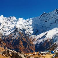
Annapurna Base Camp Trek
Annapurna circuit trek is considered as
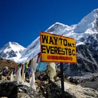
Everest Base Camp Trek
Annapurna circuit trek is considered as